Indian Navigation and Map Apps - Alternatives to Google Maps

Best Indian Alternatives to Google Maps - Navigation & Map Apps

Google Maps collects and stores Indian users' location data on US servers, creating data sovereignty concerns, potential DPDP Act compliance issues, and dependency on a foreign platform for critical navigation infrastructure. Indian navigation apps are specialized digital mapping and navigation applications designed to cater to India's unique and diverse road conditions. These Made in India map apps provide detailed maps down to the house number level, real-time traffic updates, turn-by-turn voice guidance in Indian languages, hyperlocal safety alerts, and offline navigation support. Developed by both private Indian tech companies and government organizations like ISRO, they offer a robust data sovereign alternative to Google Maps for Indian users and developers.

Mappls MapmyIndia - Best Indian Alternative to Google Maps Navigation

Mappls

India 🇮🇳

Mappls, from MapmyIndia, is India's top Swadeshi navigation app providing detailed maps down to the house number level. It features 3D junction views to help with complex flyovers, real-time traffic updates, and safety alerts for speed bumps and potholes. Multilingual voice guidance supports Indian languages, making it a comprehensive data-sovereign alternative to Google Maps for Indian users.

MapmyIndia - Indian Maps API SDK Google Maps API Alternative

MapmyIndia

India 🇮🇳

MapmyIndia is India's digital mapping pioneer since 1995, powering the Mappls app and offering a comprehensive Maps API and SDK as an Indian alternative to Google Maps API. They provide offline maps, live traffic data for Indian cities, in-car navigation systems, and developer solutions - with all map data created in India and hosted on Indian servers.
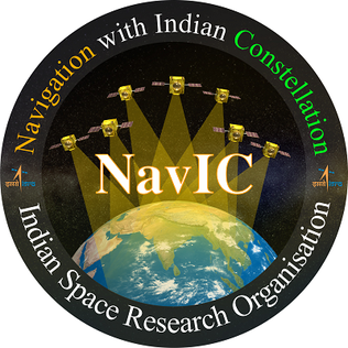
NavIC ISRO - Indian Satellite Navigation System GPS Alternative

NavIC

India 🇮🇳

Navigation with Indian Constellation (NavIC) is India's own satellite navigation system developed by ISRO - India's sovereign alternative to GPS (USA), GLONASS (Russia), and Galileo (Europe). It provides accurate positioning for India and surrounding regions for terrestrial, aerial, and marine navigation, vehicle tracking, and disaster management, with signals generated and controlled entirely within India.

Ola Maps Krutrim - Indian Maps API Navigation Google Maps Alternative

Ola Maps

India 🇮🇳

Ola Maps is a navigation service by Ola Krutrim focused on India's unique road conditions. It provides real-time traffic updates, accurate turn-by-turn directions, and developer-friendly Maps APIs and SDKs for integration into applications - serving as an Indian alternative to Google Maps API for developers who need routing, geocoding, and location services with data hosted in India.

Bhuvan ISRO - Indian Geo-Portal Government Maps Google Maps Alternative

Bhuvan

India 🇮🇳

Bhuvan is ISRO's Indian geo-portal offering geospatial services, satellite imagery, real-time location tracking, and voice-guided navigation via Pocket Bhuvan. Beyond navigation, it provides critical data for disaster management and natural resource management - a uniquely Indian, government-backed mapping alternative to Google Maps with complete data sovereignty and no foreign dependency.

Bhuvan Lite ISRO - Indian Satellite Earth Observation Maps Alternative

Bhuvan Lite

India 🇮🇳

Bhuvan Lite is ISRO's simplified geo-portal designed for easy, lightweight visualization of Earth observation data from India's own satellites. It offers a fast, accessible interface for users who need quick access to geospatial and satellite imagery data - all powered by Indian space technology with no foreign data dependency.

FAQ'S

Frequently Asked Questions
Indian Alternatives to Google Maps

The best Indian alternative to Google Maps is Mappls by MapmyIndia - offering house-level detail, 3D junction views, real-time traffic, safety alerts for speed bumps and potholes, and multilingual Indian language support. Ola Maps is another strong Indian alternative with real-time traffic and a developer-friendly Maps API with data hosted in India.

Yes. Mappls (MapmyIndia) and Ola Maps both offer Maps APIs and SDKs for Indian developers - with geocoding, routing, real-time traffic, and search capabilities. These are direct Indian alternatives to Google Maps API, with data hosted in India, INR billing, and DPDP Act compliance.

Indian navigation apps like Mappls and Ola Maps offer data sovereignty (location data stays in India), DPDP Act compliance, better accuracy for Indian roads (house-level maps, speed bump and pothole alerts), multilingual Indian language support, offline maps for rural areas, and INR billing for API usage - advantages Google Maps cannot offer for Indian users.

Yes. NavIC (Navigation with Indian Constellation) is India's own satellite navigation system developed by ISRO. It provides accurate positioning for India and surrounding regions for terrestrial, aerial, and marine navigation, vehicle tracking, and disaster management - India's sovereign alternative to GPS (USA), GLONASS (Russia), and Galileo (Europe).

Mappls is India's Swadeshi navigation app by MapmyIndia. Unlike Google Maps, Mappls offers house-level detail mapping across India, 3D junction views for complex flyovers, hyperlocal safety alerts (speed bumps, potholes, accident zones), multilingual Indian language voice guidance, and data hosted entirely within India - ensuring DPDP Act compliance and data sovereignty that Google Maps cannot provide for Indian users.

Yes. Ola Maps offers real-time traffic updates, accurate turn-by-turn navigation for Indian roads, and both Maps APIs and SDKs for developers - making it a viable Indian alternative to Google Maps. It is backed by Ola Krutrim, an Indian AI company, with location data hosted in India and designed specifically for India's road conditions.

Bhuvan is ISRO's Indian geo-portal offering geospatial services, satellite imagery, real-time location tracking, and voice-guided navigation via Pocket Bhuvan. Unlike Google Maps, Bhuvan also provides data for disaster management and natural resource management from Indian satellites - making it a uniquely Indian, government-backed mapping alternative with complete data sovereignty.

MapmyIndia and Mappls offer offline maps for India - users can download maps for specific regions and navigate without internet connectivity, especially useful for rural areas and regions with poor connectivity. Bhuvan Lite also provides lightweight access to ISRO satellite data, all hosted on Indian government servers.